Estimating and simulating vehicle traffic by road segment provides key information for a wide variety of analytical projects. From the demand for service stations and restaurants to the design of transport networks and out-of-home advertising audiences. Below, we look at some examples.
Vehicle Traffic Simulation Methodology
We have developed a road traffic simulation, which is part of our market data offering for location intelligence, using a methodology similar to the one used to simulate pedestrian traffic.
The model is trained through agent-based simulation, of the «origin – destination» type, based on data from:
- Residential population
- Working population
- Companies
- POIs of all types
- Road geometry and traffic directions
- Macro mobility studies
Using Monte Carlo techniques, for each possible origin node of the road graph, a set of destinations is generated based on gravitational models—common in analytical geomarketing.
From the data and techniques described, hundreds of millions of possible routes between origins and destinations are simulated, organized around probability distributions, which are in turn determined by the «efficiency» of each possible route. Routes are calculated at three levels based on the time they consume:
- Short distance: up to 15 mins
- Medium distance: 15 mins – 1 hour
- Long distance: > 1 hour
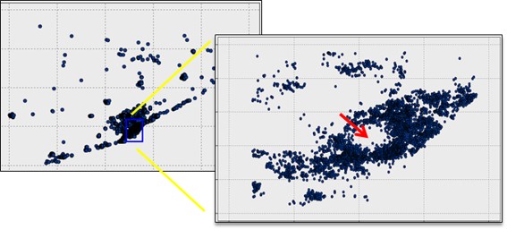
The model returns a synthetic vehicle intensity index which is subsequently validated, calibrated, and rescaled to the number of vehicles using real observations from different sources: induction loops/sensors, cameras, GPS data, and mobile network operator data.
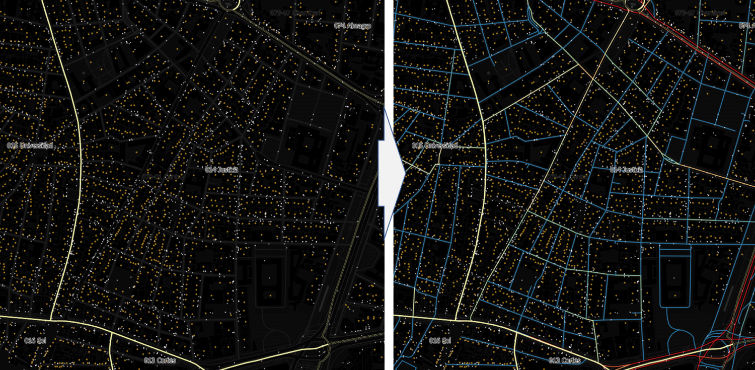
The image shows addresses with population in Madrid and points of interest. The simulation of movements from these residents (origins) and the trips to these points of interest (destinations) results in the vehicle traffic indices represented on the right.
Vehicle Traffic in Location Intelligence and Geomarketing
Vehicle traffic can be a key indicator in estimating the demand for many types of establishments located along roads.
- Service stations (gas stations, EV charging stations, and likely hydrogen in the future)
- Roadside restaurants, hotels, fast food
- Vehicle services: repair shops, car washes
- Out-of-Home (OOH) advertising (billboards, monoposts, transit shelters, banners…)
Vehicle Traffic and Demand for Service Stations, Restaurants, Hotels, and Workshops
This is one of the most common applications of road traffic in location intelligence. It is clear that the primary demand for roadside businesses is determined by the volume of traffic on those roads. Essentially, these businesses can choose from three types of locations:
- Location at origin: mainly residential areas—»the trip starts at your usual service station.» In this case, knowing the population and their travel frequency/vehicle use is sufficient.
- Location at destination: near companies, transport terminals, borders… the KPI will be the presence of companies and working population in the area, or the flow of transport/borders.
- Location in transit: halfway between origin and destination. This represents the greatest opportunity since the need for refueling or food arises mid-journey, and it is often easier and more cost-effective to open a business in this type of interurban location. In this case, accurately estimating road traffic is critical and essential.
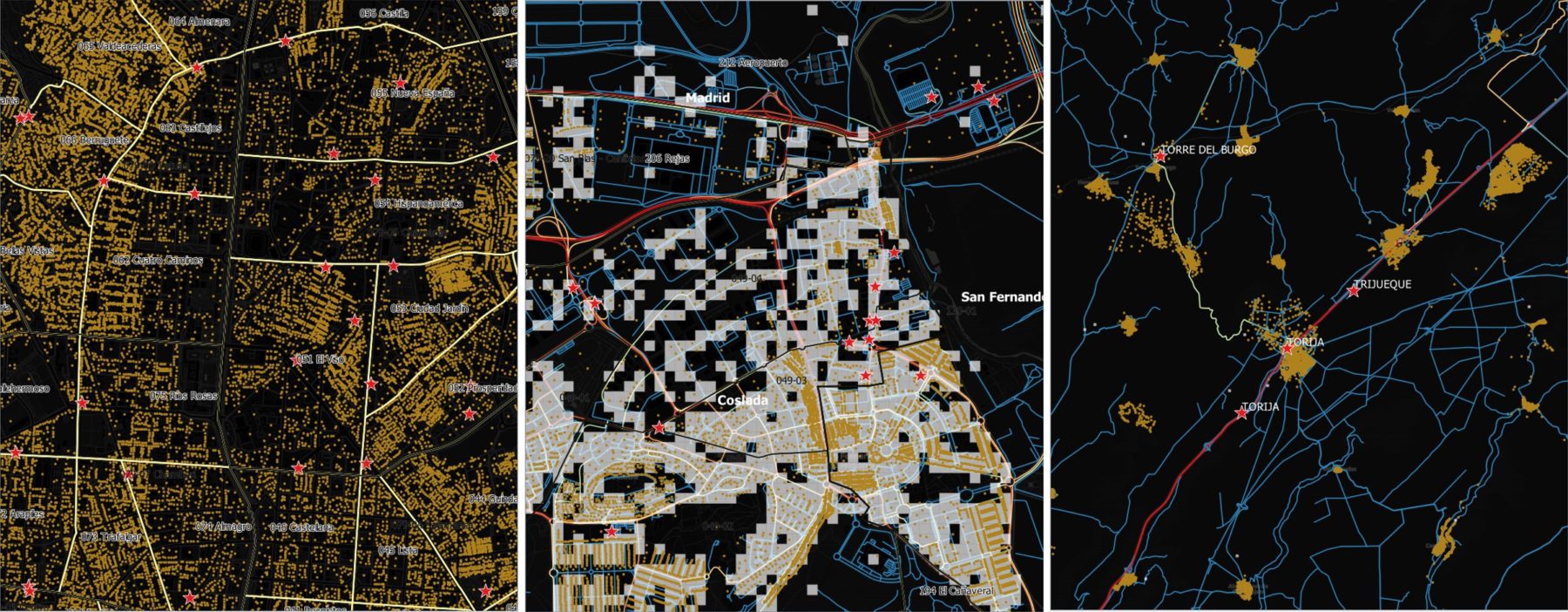
Service stations and location type: center/origin (Madrid city center), destination (Coslada industrial park/airport), transit (N-II highway)
Vehicle Traffic and Out-of-Home (OOH) Advertising Audience
Out-of-home advertising is relatively inexpensive and—according to many studies—shows a higher ROI than more traditional media. As argued by this Magna study on OOH, it has resisted the digitization process better than other media and also benefits from two major trends:
- Mobility: every day we increasingly «live in transit.»
- Technology: the capacity to apply technology for message personalization and audience measurement is enormous; combined OOH and mobile campaigns increase CTR by up to 15%.
Precisely, these are the advantages provided by a good road traffic estimate: personalization and measurement.
- OOH Content Personalization: knowing the sociodemographic characteristics of travelers, the reason and type of trip (work, leisure, distance, and time), as well as their origin and destination, opens huge possibilities for segmentation and increasing message effectiveness.
- OOH Audience Estimation: a road traffic model perfectly complements spot observations or counting systems integrated into displays, as it enables extrapolation to new locations.

Road Traffic Simulation and Road Network Design
The described methodology presents several strengths for simulating and analyzing transport network modification scenarios:
- Fine Granularity: the model is built and delivered broken down for each of the 5.5 million road segments in Spain, providing greater precision than the 150-250m grids common in other approaches like mobile operator data.
- Enables Personalization: from the origin-destination matrices and road network conditions, it is simple to develop ad-hoc models adapted to specific industries: passenger vs. freight transport, vehicle type, trip purpose, seasonality, time of day…
- Simulation and Scenarios: since the model is generated through simulation, it is very easy to adapt for scenario simulation: road alterations due to construction, security threats, new access points, pedestrianization, road widening…
- Cost: The model cost is very competitive compared to other approaches like GPS data, WiFi sensors, or mobile operator data, which would require massive samples to achieve consistent national coverage.
All this makes this type of model ideal for analyzing mobility needs and simulating all kinds of scenarios:
- Road network expansions: new access points, road doubling.
- Road network modifications: directions, pedestrianization, speed limits.
- Modification of the offer for other transport modes, public or private.
- Urban planning, analysis of noise, pollution, and traffic calming measures.
- Scenarios for trip modifications linked to urban growth, commercial offers, industrial parks, or transport terminals.
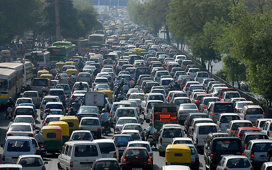
The benefits of having a vehicle traffic model are enormous in the fields of urban planning and mobility.